We are hiring! Run with Riesterer and Schnell: Apply Today


We are hiring! Run with Riesterer and Schnell: Apply Today
Search
Choose a Location

Increase the efficiency of your field operations with Gen 4 In-Field Data Sharing by monitoring the operations of up to six tractors, sprayers, nutrient applicators, or combines on one screen.
Equipment can work together at the same time or use maps created earlier by another machine to perform the following:
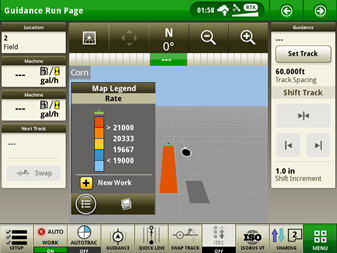 Layers and legends
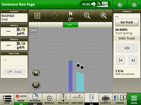 Three machines sharing coverage
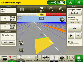 Sharing as-applied maps
Sharing maps and vehicle position helps confirm proper performance and help producers manage operations in the field.
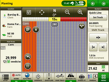 Whole field view
Using In-Field Data Sharing’s Join feature, an operator can quickly join geospatially sorted work groups and accept the client, farm, field, and guidance line as well as crop and other documentation entries. The person starting the work group can either send everything or select only what they want the other operators to use.
With the Join feature, starting a field is faster and will result in more consistent usage of guidance lines and documentation data.
Using a streamlined setup process, In-Field Data Sharing matches maps and guidance lines together based on the information selected in the Work Setup screen; the same information is needed to document an operation. Setup items can be sent to the display from Operations Center for selection to make setup even easier.
The information needed depends on the operation:
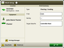 Work Setup and Work List
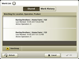 Shared Work
By joining a work group, you can view and select work history and shared work from a different time if different maps are required to finish an operation. Accessed from the Work List screen, Shared Work displays the data available from the cloud, while Work History displays the information created using the display. For example, if multiple herbicide applications are being made, a previous application can be selected to finish the field.
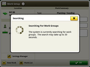 Searching for other work groups
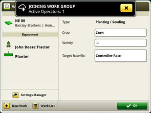 Joining a work group
Shared work data is sent and received in 30-second segments. Including data transfer, a display will typically receive updates to coverage from group members approximately every 30 seconds and updates to group member position approximately every 6 seconds.
NOTE: Data transfer times can vary depending on strength of data connection.